
|
Welcome to the Neighbourhood
A Brief History
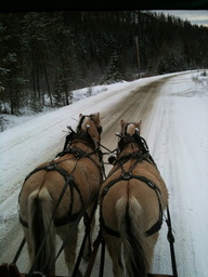
This neighbourhood spans from Yahk to Riondel. The history of an area dramatically influences the present-day character and quality of its community. This area is where the land and water people unite. The cluster of communities was primarily settled in the early 1900s. Creston was first settled in 1883 by European settlers as a regional mining and exploration post and later to develop a forestry and agriculture economy. Riondel community, at the northwest section of the valley, is located on the Kootenay Lake or otherwise known as the East Shore. It was renamed from Hendrex to Riondel in 1907. The community of Yahk is at the other end of the larger community beyond the valley, but it is on the Moyie River, which is a tributary of the Kootenay River and Lake. Yahk was first settled when the Canadian Pacific Railway laid a siding in 1899.
Most recently, the area's lifestyle attracts a growing number of retirees and young families. But it was the Yaqan Nuki people (with regards to the current administration, they're known as the Lower Kootenay Band) who were the first inhabitants of this region. For more history visit the local museum.
Most recently, the area's lifestyle attracts a growing number of retirees and young families. But it was the Yaqan Nuki people (with regards to the current administration, they're known as the Lower Kootenay Band) who were the first inhabitants of this region. For more history visit the local museum.
How to find your match
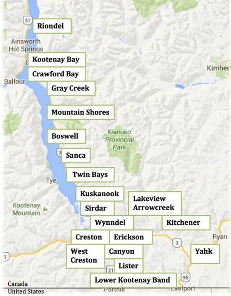
Creston Valley & Kootenay Lake Communities
|
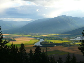
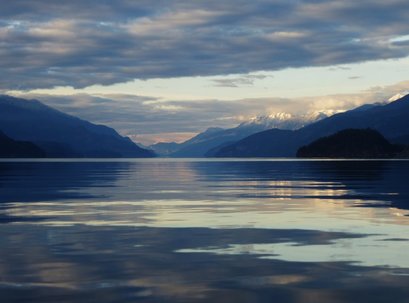
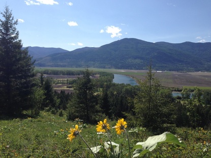
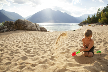
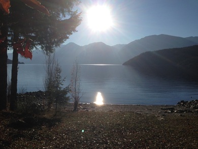
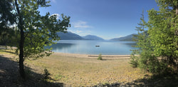
The sweet spot of the Kootenays! We are located halfway between East Kootenays and West Kootenays. The convenient central location is perfect for enjoying all that the Kootenays has to offer while living in the sweetest place. The sweetest place can also refer to being a sweet spot in the Kootenays. At this optimum point, you have access to an abundance of fresh locally produced food, outstanding natural beauty, fantastic outdoor recreation, and charming neighborhoods. Our communities are all within the Regional District of Central Kootenay (RDCK) regional boundaries and are often grouped as Areas A, B, C, and Creston. Creston Valley Map The combined population is 13,172. 2016 Census Stats for the Kootenays. There are several public schools and a college campus within this area. The Creston Valley Hospital & Health Centre is a Level 1 Community Hospital in the East Kootenay health service area. Located in Creston, the hospital offers services including surgical, inpatient and emergency. The locals refer to the communities on the east shore of the Kootenay Lake, from Kuskanook to Riondel, as one large community called East Shore. The other communities in this area are referred to as Creston Valley, except for Kitchener and Yahk. It is worthwhile noting that the Creston Valley and East Shore do not switch over to "Daylight Savings Time." It always stays at the same time year-round. The average drive time to these neighbourhoods from Creston is about 10 minutes, except Kitchener, which is around 15 minutes east on Highway 3, and Yahk is about 30 minutes east. Heading north on Highway 3A takes you to Boswell in nearly 30 minutes, Crawford Bay in 45 minutes, and Kootenay Bay/Riondel about 60+ minutes depending on seasonal traffic. Each one of these neighbourhoods has its unique character and qualities that are influenced by their history, geography, and rural living. Our people naturally learn to be resourceful and collaborative. The following is my impression of each neighbourhood but I highly suggest you talk to the people that live there to find out what makes it special to them. This is a place where you can be your genuine self.
|
Resident's Story:
"A few years ago, Angela and I talked about moving back to Calgary to be closer to our grandchildren and for a brief few months the prospect seemed exciting. The idea faded though once we considered all factors. The simple fact is that we are more in the love with Creston Valley than we were when we moved here more than 37 years ago." - Lorne Eckersley, This Is The Life, Creston Valley Advance Dec. 29/16 History Holders - How did we get here?
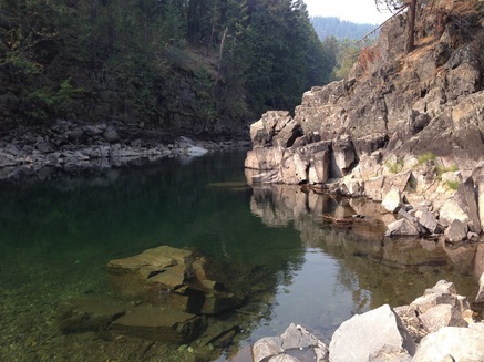
This link will take you to stories told by our elders about our local history. Stories answer questions, such as: Who saved Wynndel from the fire of 1945? Who were the little slaves living in Utopia? How did the rocks in the Riondel area get turned over? What is 350 feet below the surface of the Kootenay Lake and 250 feet above it? |
|
|
|
The following communities are not presented in any particular order.
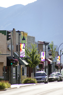
About Creston
Town of Creston "Home - Nutured In Nature" - Map Creston is a service hub for the neighbourhoods within the Creston Valley and the East Shore of Kootenay Lake. Creston is a cozy town. In my opinion, it pretty much has every primary service I can imagine wanting and needing. Creston also has a hospital, college campus, library, an award-winning recreation center, a busy shopping area downtown, and uptown as well as many social services. International Columbia Brewery is a significant contributor to the tax base along with other “bricks and mortar businesses.” Real estate in Creston is very affordable compared to other places in the province. However, housing in town is more expensive than rural houses. Read More... |
|
|
About Wynndel
"Fields to Forests"
The rural hamlet of Wynndel is a 10-minute drive north of Creston. Most residents have access to municipal water, natural gas, fire protection, the Wynndel Memorial Hall, and the neighbourhood convenience store, Wynndel Foods, and Gas. Adding to the tax base is Canfor Wynnwood Sawmill. Wynndel has easy access to Duck Lake for outdoor recreation from the flats and historical Sirdar. Many Wynndelites enjoy the close approximately to Kuskanook Harbour on the Kootenay Lake. Fair priced properties for sale in the Wynndel area are often in demand. |
About Crawford Bay
"Artistic By Nature"
Crawford Bay is an eclectic community located on the Kootenay Lake 60-minute drive from Creston. Each summer, tourists arrive to meander through the shops within the artist community. It has seasonal restaurants, a year-round convenience store, and a K to 12 school. There is a public beach in the bay within walking distance of the campgrounds. Located within the community is one of BC’s most scenic golf courses, Kokanee Springs. This area is becoming known for mountain biking. A local trail map makes it easy for newcomers to get out on the trails, either on foot or on a bike. View more - read More... |
|
|
|
About Erickson
"Growing Together"
This agricultural community borders the Town of Creston. Locals and visitors treasure the roadside fruit stands and wineries. Within this farming area are a few pockets of residential neighbourhoods. I particularly love being in Erickson during blossom season and late summer when the fruitstands are overflowing with produce. And now we are fortunate to have vineyards with wineries: Skimmerhorn Winery and Bistro, Baillie-Grohman Winery, and Red Bird Wine. Also, Wynnwood Winery in Wynndel. |
About Canyon
Canyon is a farming community about 10 minutes drive from Creston. When the people of the Creston Valley think of Canyon, they likely think of fly-fishing on the Goat River or orchards or horses. Historically Canyon Park hosted Chuckwagon or Chariot Races during the Blossom Festival weekend. Now the grounds is mainly used by the 4H Club and Creston and District Community Complex programs, and the campground for special events. Residents are fond of their community hall, school and convenience store.
|
|
|
About Lister
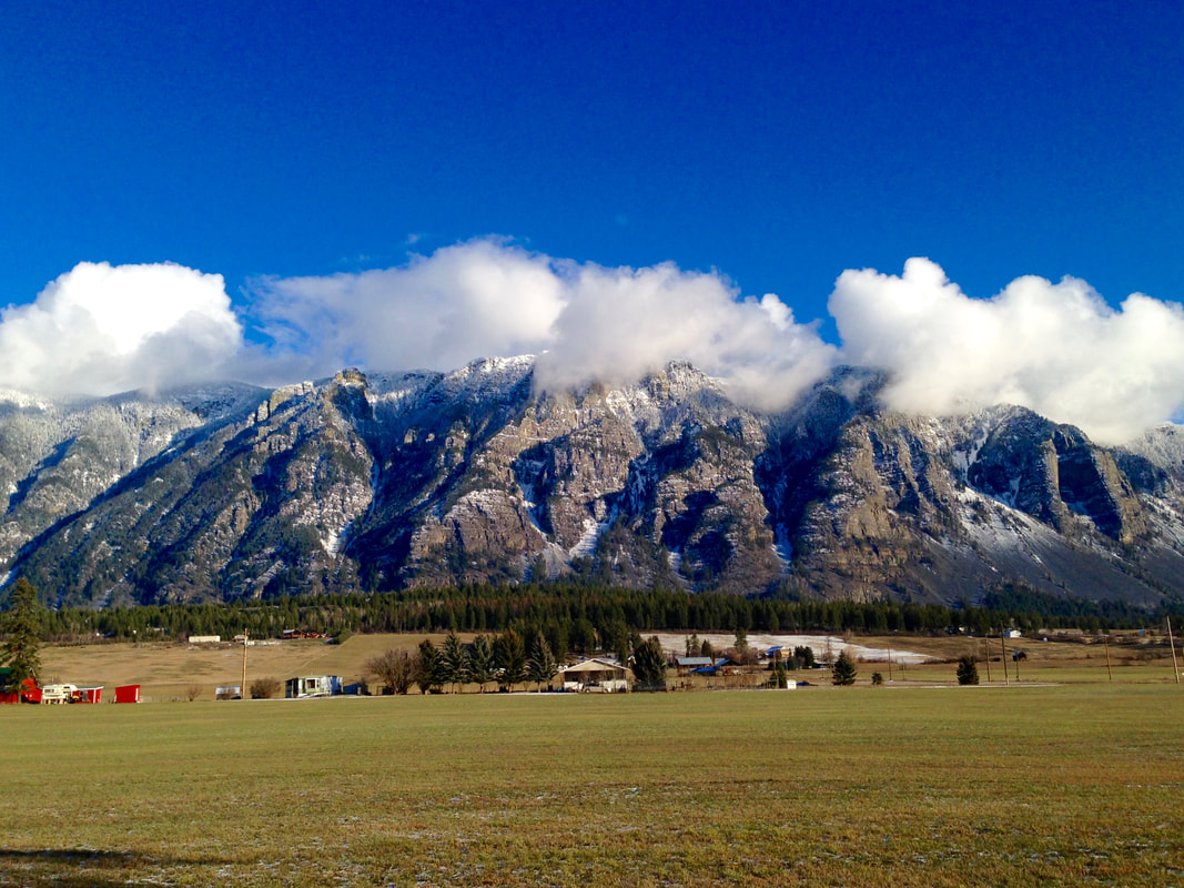
Lister is an agricultural community 10-minutes drive south of Creston. The wide-open spaces in Lister provide for some fantastic views of the Skimmerhorn mountains and vistas of rolling farmlands.
The airport located here is vital to the valley as a whole. Theairport serves local pilots, emergency air ambulance, and forestry firefighting. TheCreston Valley Golf Course located in this area is known for its scenic championship 18 holes beautiful course design and busy clubhouse restaurant. Properties for sale in this area are in demand. I particularly love riding my bike in Lister. Most people who move to this area now do so for its pastoral setting. There are founding families in this area whose forefathers settled in this area to farm. |
About
|
|
|
|
About West Creston
This community is a short 10-minute drive from Creston. The West Creston Hall is a hub of activity. West Creston provides excellent opportunities to spot wildlife and to birdwatch throughout the Creston Valley Wildlife Management Area. This area also includes some fantastic walks through the wetlands and channels. West Creston is also known for flatwater canoeing or kayaking.
I particularly have enjoyed their down-home fun events, including "Corn Krickers Picnic", where you can join in on a 3 Legged Race, partake in Rolling Pin throwing contest, and even Chicken Shitting Bingo. |
About Kitchener
Kitchener is a 15-minute drive from Creston. Outdoor recreationists enjoy this area because it provides access to ATV trails, fishing holes, and hunting grounds. The weather here dips down in the winter from the rest of the valley, but those who live here don’t care because they play in the snow, their taxes are cheap, fuel for wood stoves is plentiful, and they live on route to Cranbrook for its additional services.
|
|
About Yahk and Kingsgate
|
The community of Yahk was developed when the CPR laid its first track back in 1899. The trains still run through this area. It is situated on along the Moyie River.
|
Yahk is a 30-minute drive from Creston along Hwy 3. Outdoor recreationists and individualists are attracted to live here. This friendly community cherishes its beautiful Hall. There are a couple of convenience stores with fuel, touristy stores, and 3 RV parks. The Yahk Provincial Camp Ground is conveniently located just off the highway and along the Moyie River.
I have to smile when I think of the community of Yahk Kingsgate because of their hospitality and enthusiasm, for example their fun filled festivals. Many visitors are attracted to this area for its camping, ATVing, and snowmobiling. The Yahk Provincial Camp Ground is conveniently located just off the highway and along the Moyie River. When visiting, the locals ask that you please remember to help keep Yahk area pristine by packing out your garbage. |
About Lakeview Arrowcreek
This rural community is nestled behind Goat Mountain or Arrow Mountain and can be accessed off Hwy 3 at Arrow Creek Rd (leaving the east end of the valley after Erickson) or off of Hwy 3A at Lakeview Rd. (between Wynndel and Creston).
Lakeview is considered part of Wynndel but they do have their own identity.
Lakeview is considered part of Wynndel but they do have their own identity.
|
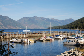
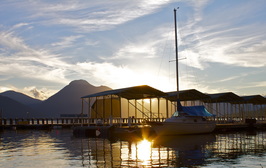
About Kuskanook Harbour
Kuskanook is about 25 minutes north of Creston and 15 minutes drive from Wynndel. This historical 1900 site once had lake boats and trains pulling up to the buildings that are now gone, mostly due to fires. Apparently it is said that Kuskanook once had 17 saloons. Now this site comes back to life in a different way, on warm summer days boaters arrive with picnic baskets and water toys. The people who live along this section of Hwy 3A section are mostly seasonal residents. The Kuskanook Harbour Society is responsible for maintaining the harbour. Contact the society if you are interested in docking a boat here.
|
About Twin Bays and Sanca Creek
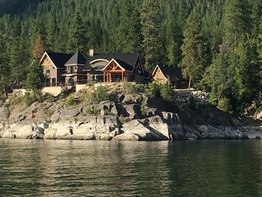
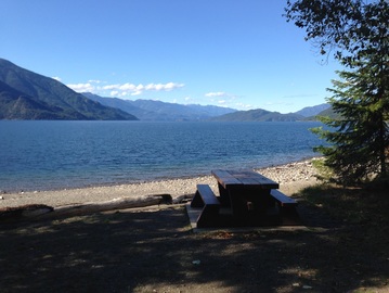
The Twin Bays community is a short drive off the Highway 3A and resides within two bays. One bay has a beautiful public beach, and the other holds a marina. There is an available parking lot within walking distance of the beach access and an outhouse. There are several luxurious homes amidst the average priced lake homes.
Sanca Creek also has public beach access, but it doesn't have the same beach setting, nor the outhouse availability. The community has a few full-time residents who enjoy the serenity in the winter months. Sanca Creek also has access to back-country roads where you can access mountain lakes. One local favorite is Wooden Shoe Lake. Twin Bays is about 20 to 30 minutes from Creston, and Sanca is a little further north. |
|
About Boswell
Boswell is a stretch of area that follows the Kootenay Lake shoreline on Highway 3. The active Boswell Hall is a short 30-minute drive from Creston. Local recreationists, especially fisher-persons, make good use of the Boswell Boat Ramp.
Most of the housing is along the lake. There are a few communities within Boswell, such as Twin Bays, Sanca, and Destiny Bay, with its convenience store. Mountain Shores Resort is another community within Boswell. This gated community makes rural living look easy (they even have their marina with fuel). The community hall has a packed calendar of events. Residents seem to know how to make their own fun and take care of their community's needs. There are many seasonal residents along this section of the east shore of Kootenay Lake, but there are many more who are full-time residents with their enthusiasm to make up for those who are absent. These people love the lake and the outdoors, and they attest to the lake being responsible for the apparent longevity of its people. Residents describe their community as "inclusive not intrusive". Public lake access sites are not easy to find unless one of the locals points them out to you or you go to the RDCK maps or Creston Valley Trails website. These maps can help you to find those access points. |
|
|
About Gray Creek
Today there are many seasonal residents in Gray Creek who make this beautiful location along Hwy 3A their “home away from home.” A visit to the historical Gray Creek Store tells tales of life here from 1913 on; it is an excellent source for local knowledge and household goods.
Gray Creek Hall is a 100 year old log building. It provides a cozy space, with lake view, for residents to congregate in and workshops to be hosted. For a family adventure visit the Tipi Camp on Pilot Point, just a short boat ride from Gray Creek. |
About Kootenay Bay
This area is around the corner from Crawford Bay. The world's longest free ferry ride (30 minutes) takes you over to the other side of the lake to the community of Balfour. There is a public boat launch near the ferry landing. A short drive along Pilot Point will take you to Pilot Point trail head. This trail follows along the lake and gives you access by foot to a provincial marine park and other beaches. A little further down the road is a trail head to a historical lighthouse where you can enjoy an amazing view of the lake.
|
|
About Riondel
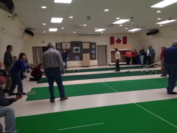
Riondel is a town located on the Kootenay Lake at the end of the lake road. Riondel’s history goes back to 1882 when it became a booming mining town until the Bluebell Mine closed in 1972. Now it is a haven for retirees and mobile workers. This little town has a fire department, grocery store, restaurant pub, internet service, and community center with curling rink. It has an active community that includes the performing arts. Within its town limits is a beautiful park along the lake with camping facilities. Summer tourists provide a welcome change of pace for full-time local residents. The Riondel Golf course is enjoyed by those who don’t take the game too seriously and enjoy life as it comes. The Yasodhara Ashram, a yoga retreat and study centre is a special place to visit whether to partake in one of their programs or to drop by for a short visit.
|
|
The knowledge contained within these articles are based on my decades of local personal and business experience, as well as the knowledge I have gleaned from other local residents. I am not an editor but I am an active enthusiastic resident who cares deeply for her community and has responded to a need for this type of information by creating this website. Please contact me if you see anything that needs updating or correcting or you feel should be included. Thank you, Debby Johnson

|
|
Site by: SC
|